
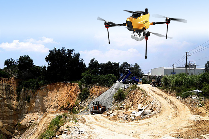
DRONE-ECO PRO, ONE EFFICIENT AND SURVEY-ORIENTED PROJECT HELPER
SOUTH Drone-eco Pro is one of the most compact industrial-grade intelligent UAV drones on the market, with the advantages of easy operation, high accuracy, long flight duration and so on. The Drone-eco Pro can fully meet 1:500 topographic mapping, cadastral mapping, earthwork survey, 3D GIS system and other applications....
Read more
WGDC2021 | THE MOST-WATCHED TECHNOLOGY COMPANY IN THE YEARS | SOUTH GROUP
From May 18th to 19th, the 10th World Geospatial Developers Conference (WGDC2021) was held in Changsha, Hunan Province. South Group was invited to participate in the conference and won two awards: South, Baidu Maps, Didi, Huawei, Tencent Location Services and other companies were jointly rated as WGDC’s most-watched technology companies...
Read more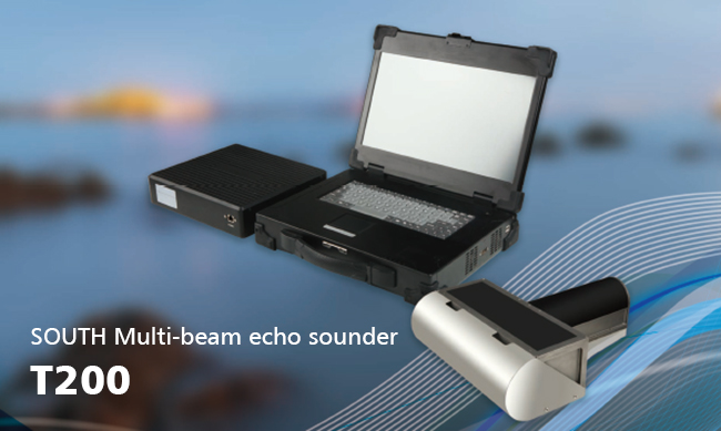
SOUTH MULTI-BEAM ECHO SOUNDER T200
There are some differences when we use single beam echo sounder and multi-beam echo sounder for hydrographic survey. As the above pictures, Picture A measured with single beam echo sounder system, Picture B measured with multi-beam echo sounder system. If we need to use for volume calculation, salvage, under...
Read more
2021 SOUTH NATIONAL USER CONFERENCE
Presenting A New Picture of Geo-Spatial World On April 6, the “Presenting A New Picture of Geo-Spatial World” 2021 South National User Conference was officially opened. It consists of 28 conferences and more than 60 sub-forums, and has been held in Jinan, Shanghai, Changsha, Tianjin, Beijing, Guangzhou and other cities....
Read more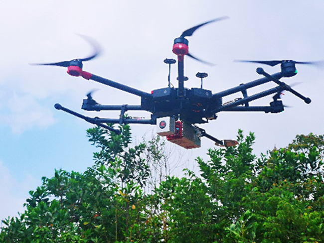
CAMPUS TOPOGRAPHY BY UAV-BASED LIDAR SURVEY
Z-Lab team undertook a topography surveying and mapping project, the project duration was tight and the output demands were high. All the outputs will be compared with the ultrasonic radar equipment developed by the client. Office Work Data Processing: 7 daysOutput1: geo-referenced point cloud Checkpoint Report in TerraSolid: root mean square 0.044 m standard...
Read more
FIELDGENIUS FOR ANDROID IS COMING!
After times of testing and communication with MicroSurvey engineers,the FildGenius for Android compatible with SOUTH all series receivers is released now. It contains all new and old type SOUTH receivers drivers like G6, G1plus, S660N and S82T, S82V etc. The FieldGenius for windows mobile has achieved great success and...
Read more
TKGM 70 UNITS GNSS RTK TENDER WAS WON BY SOUTH
With premium quality and continuously innovated features, SOUTH New G1 Plus is the most favorite GNSS receiver model of many surveyors worldwide, especially in Turkey. In the year 2020, a series of new technologies have been added to G1 Plus: 336 channels top class GNSS positioning chip, IMU Tilt...
Read more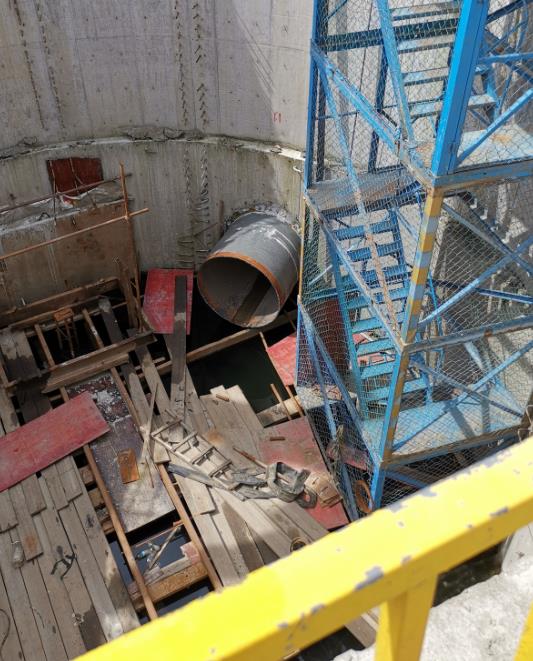
WHEN THEODOLITE MEETS PIPE JACKING
At the end of Dec.2020, the water diversion project from Ningbo to Hangzhou Bay was started, which crosses 4 districts & cities, 15 towns and streets with a total length of 69.2 km. The planned water transmission line of culvert is 28.777 km long and the pipeline is 40.423...
Read more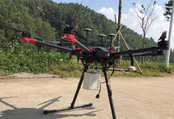
RURAL ROADWAY DEVELOPMENT TOPOGRAPHY WITH LiDAR SURVEY
Job Time: Nov 2020Job Location: Guangzhou, ChinaArea Size: 0.08 sq.kmJob Target: 1:1000 topographyAccuracy Expectation: elevation 10 cmOutput Demand: point cloud, DEM, contoursChallenge: inaccessible, hilly terrain Survey Solution: Hexacopter Matrice600 Pro + Z-Lab LiDAR-eco Number of Flight: 3 flights Take-off Point: 2 spotsFlight Altitude: approx. 80 m for each flightFlight Duration: 36 minutes in totalNumber of Checkpoint: 70 points by GNSS RTK measurement Fieldwork:almost 1 day (lots of time invested in terrain analysis and take-off point...
Read moreRecent News


SMART MONITORING SOLUTION FOR DAM OF WOHUSHAN RESERVOIR

LIVE BROADCAST|VISIT ONLINE EXHIBITION WITH Mr.Ma

Recent Comments