By southadmin
Feb 24, 2021
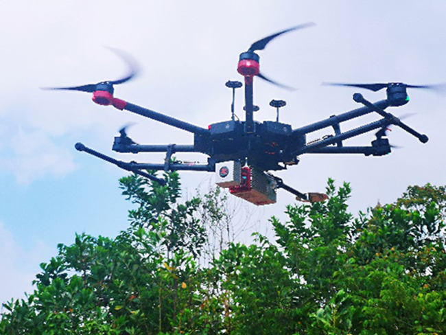
CAMPUS TOPOGRAPHY BY UAV-BASED LIDAR SURVEY
Z-Lab team undertook a topography surveying and mapping project, the project duration was tight and the output demands were high. All the outputs will be compared with the ultrasonic radar equipment developed by the client. Office Work Data Processing: 7 daysOutput1: geo-referenced point cloud Checkpoint Report in TerraSolid: root mean square 0.044 m standard...
Read moreRecent News


December 13, 2021
SMART MONITORING SOLUTION FOR DAM OF WOHUSHAN RESERVOIR

December 1, 2021
LIVE BROADCAST|VISIT ONLINE EXHIBITION WITH Mr.Ma

November 30, 2021
Recent Comments