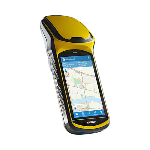
- HD large 5-inch touch screen which fulfill the Android users needs
- Android version supports multiple languages switch
- Quad-Core 1.3GHz processor
- Micro-USB port and OTG function
- Being equipped with laser centering component
- Multiple sensors and more extended functions
| System | Operating system | Android 5.1/ 6.0 |
| CPU | Octa-Core 1.5GHz | |
| Memory | 3GB RAM, 32GB ROM | |
| Storage | up to 128G extensible | |
| GNSS performance | Channels | 336 |
| GPS | L1, L2 | |
| GLONASS | L1, L2 | |
| BDS | B1, B2, B3 | |
| GALILEO | E1C, E5A, E5B | |
| SBAS | – | |
| QZSS | – | |
| Data output | NEMA-0183 | |
| I/O protocol | RTCM2.3 (1, 3, 9), RTCM31 | |
| Update rate | 1Hz | |
| Reacquisition | < 1s | |
| Warm start | – | |
| Cold start | < 30s | |
| Accuracy | Single positioning | 2m |
| SBAS positioning | Horizontal: 0.50m Vertical: 0.85m |
|
| DGNSS | Horizontal: 0.25m + 1ppm Vertical: 0.50m + 1ppm |
|
| RTK(baseline<30km) | Horizontal: 0.008m + 1ppm Vertical: 0.015m + 1ppm |
|
| Multimedia | Camera | 8.0 megapixel AF, flashlight |
| Display | 5.0 inch capacitive screen, 1280 × 720 | |
| Sensor | Electronic compass, gravity sensor, built-in thermometer, atmospheric pressure altimeter, light sensor and distance sensor (optional) | |
| Other function | Laser centering, external antenna port, integrated speakers and microphone | |
| Extended function(optional) | – | |
| Communication | network | LTE 4G modem |
| Bluetooth | BT4.0 downward compatible to BT2.1 + EDR | |
| WIFI | IEEE 802.11 b/g/n | |
| USB | Micro USB, support charging and OTG function | |
| Electrical | Battery | 3.7V, 7200mAh Li-Ion, 2 batteries (standard) |
| Battery life | Single battery > 10 hrs | |
| Battery charging | 2 stands charger, 4 hrs fast charging | |
| Environment | Waterproof/Dustproof | IP67 |
| Shockproof | 1.5m | |
| Humidity | – | |
| Operating temperature | – | |
| Storage temperature | -40℃ ~ 80℃ | |
| Physical | Dimension | 231mm(L) × 92mm(W) × 57mm(H) |
| Weight | 0.56kg (battery included) |
Features
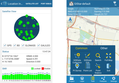
GIStar (for Android) Completely new professional Android integrate GIS application, which adopts GIS technology to collect and manage geographic data.
GIStar takes advantage of the Android touch screen capability by allowing you to tap the points and lines in your drawing to open tool bars with all the function you need instantly.
It also supports various data format import and export, such as shp file, dxf file, kml file and gpx file, which fully meets the demands of different of users.
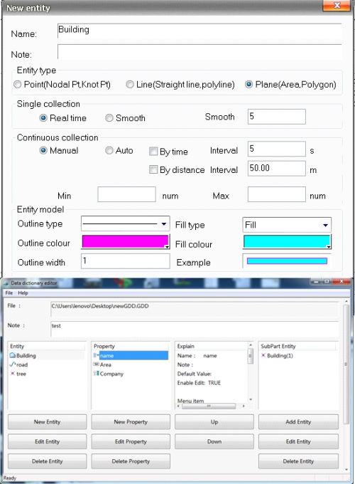
Data Dictionary Editor: A windows software that helps pre-define the GIS entity. With this software, we can describe and manage the properties of each entity. After that we just need to copy the *.GDD file which saved from Data Dictionary Editor into X6 internal storage, and then field work will be efficient and faster with GIStar.
South Precision - Copyright 2019. Developed by Web Multi Design