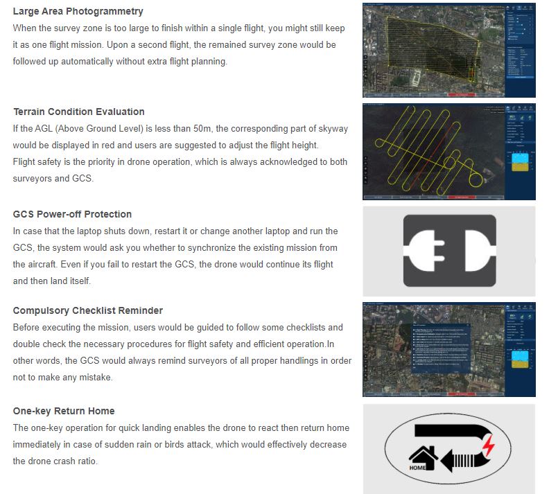
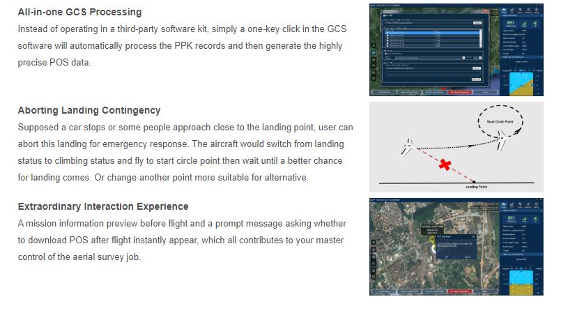
Aircraft System

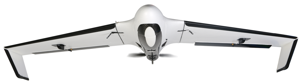
SkyCruiser A22/A22-plus
what surveyors really need…
A professional-level drone made for survey-grade mapping applications…
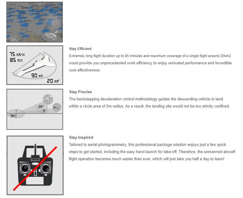
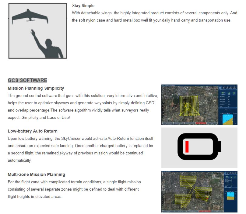
1. Simple assembly and quick hand launch
2. Humanized GCS software with interactive interfaces
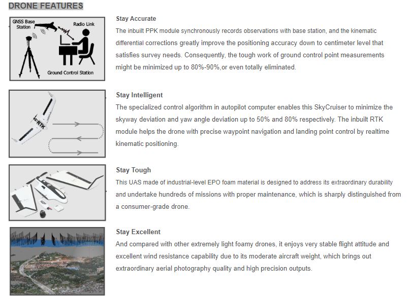
3. Excellent flight attitude due to moderate drone weight
4. Quality imageries to generate survey-grade outputs
5. Reasonable costs versus high work efficiency
6. Trusted local dealer and renowned survey manufacturer standby
SkyCruiser A20 series understands 100%
What shall be considered before purchasing a mapping drone?
1. Easy operation
2. Automated control
3. Output quality
4. Survey-grade demand
5. Cost efficiency
6. Responsive support
|
Aircraft Type Model Dimensions Packing Size
Empty Weight Body Material Propulsion System Electric Motor Power Supply |
Fixed wing, wingspan 150 cm Standard Version A22 / Professional Version A22-Plus 150 x 70 x 13 cm 98 x 36 x 46 cm (soft carrying case) 98 x 36 x 46 cm (hard transportation box) A22: 1.45 kg; A22-Plus 1.55 kg Industrial EPO foam electric pusher motor, 12-inch foldable propeller 500w Lithium polymer battery, 10000mAh, 14.8V |
Onboard Sensors
|
Autopilot Computer Airspeedometer Accelerometer Barometer Magnetometer Gyroscope GPS Receiver Integrated RTK/PPK Receiver (for model A22-Plus only) |
1X 1X 1X 1X 1X 1X 1X Built-in chipset, L1/L2, GNSS (GPS/Glonass/Compass, Galileo ready), data refresh baud rate 20 Hz, positioning accuracy up to 3 cm |
Imagery Payload
Standard Camera Sony ILCE-QX1
Sensor Type Exmor APS HD CMOS
Resolution Value 20.1 Mega Pixel
Lens Configuration Voigtlander
Focusing Length E 21mm
Aperture Control F2.8
Picture Size 23.2 x 15.4 mm
Imaging Resolution 1.5-20 cm GSD (Ground Sampling Distance)
GCS Software
Pre-flight Checks Automated
Flight Automations Automatic take-off, flight and landing operations
Camera Triggering Automated
Low-battery Warning 30%
Auto Return Upon low-battery indication
Descending Control Three-section algorithm
Fail-safe Routines Automated
Fail-safe Commands Manually controlled
Operation Performance
| Pre-flight Setup* | 3-5 minutes (A22); 5-8 minutes (A22-Plus) |
| Control Mode | AutoPilot |
| Weather Limit | 10m/s (36km/h), Beaudfort scale 6, light rain |
| Operating Temperature | -10°C to 45°C |
| Environmental Humidity | 90% condensing |
| Radio Datalink | Frequency Hopping Spread Spectrum (FHSS) |
| Control Frequency | 915 MHZ |
| Transmitting Power | 1w |
| Communication Range | Typical 10 km; max. 30 km |
Flight Performance
|
Take-off Type Landing Type Landing Space Endurance* Effective Photography Duration Range* Cruising Speed* Flight Height Height above Take-off Location |
Hand launch/automatic Belly landing Typical 20×6 m; recommended 50×10 m Not less than 59 minutes, best up to 80-85 minutes (customized unit only) Best up to approx. 70-75 minutes Approx. 80-90 km Typical 20m/s (72km/h) Max. ceiling 4000 m 70-940 m AGL (Above Ground Level) |
Acquisition Performance
|
Single-point Positioning Accuracy* Relative Accuracy (XY/Z)* Absolute Accuracy (without GCPs)* Absolute Accuracy (with GCPs)* Required GCPs |
A22: 2m CEP; A22-Plus: 3cm CEP 1-3x/1-5x GSD (A22-Plus) A22: horizontal 0.8-2m / vertical 1-2.5m; A22-Plus: horizontal down to 3-10cm / vertical down to 5-15cm A22: horizontal down to 2-3cm / vertical down to 5-10cm A22-Plus: horizontal down to 2-3cm / vertical down to 5-10cm 80%-90% or even all to be eliminated (A22-Plus) |
South Precision - Copyright 2019. Developed by Web Multi Design