Z-Lab team undertook a topography surveying and mapping project, the project duration was tight and the output demands were high. All the outputs will be compared with the ultrasonic radar equipment developed by the client.

Job Target: 1:500 topographic survey for data filing
Job Location: Chongqing, China
Job Time: Dec, 2020
Area Size: 1.84 sq.km
Job Demand
Accuracy Expectation: elevation 10 cm
Output Demand: point cloud, DEM
Submission Time: 2 weeks
Challenge: ravine, tower crane

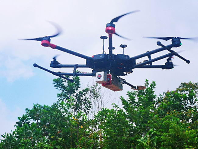
Survey Solution: Hexacopter Matrice600 Pro + SZT-R250
Number of Flight: 20 flights
Take-off Point: 5 spots
Flight Altitude: 20m – 80 m range
Strip Interval: 50 m
Data capture: 5 days (4 hours allowed to fly per day)


Flight mission in the day 
Flight mission at night

During the flight strips 
Landing at night

Office Work
Data Processing: 7 days
Output1: geo-referenced point cloud


Checkpoint Report in TerraSolid:
root mean square 0.044 m
standard deviation 0.038 m
