Background Information
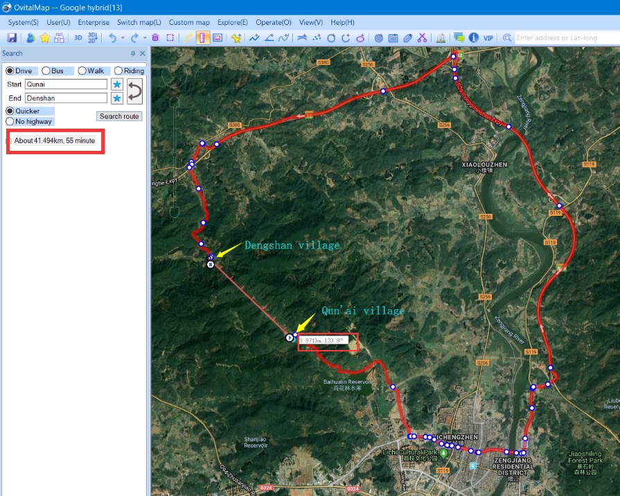
Qun’ai Village and Dengshan Village, located in Zengcheng District, Guangzhou, cover an area of 2.5 and 7 square kilometers respectively. From the map guide below, you may find that the linear distance between 2 villages is actually 4 kilometers (see below). However, without actual roadways in between, the villagers have to travel almost one hour to visit the other by using the long red route.
Recently, the roadway development of making a shortcut for these 2 villages has been put on the agenda. This survey job intended to work out the 1:500 topography for roadway planning and engineering. See below the red polygons which were the mission zones.
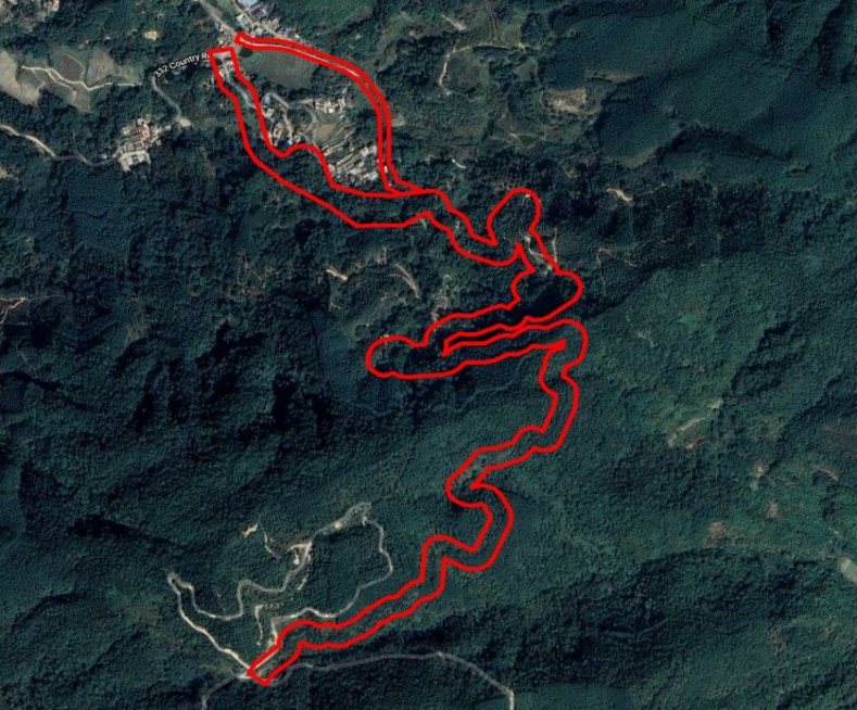
Job Area: 23 hectares (0.23 sq.km)
Output Demand:
1) DTM
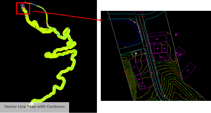
2) contours with 1m interval
3) vector line map
4) geo-referenced point cloud
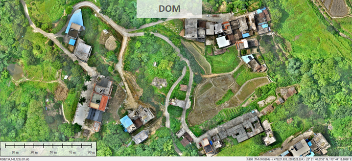
5) DOM (as a by-product)
Expected Accuracy: V. 10 c
Methodology Evaluation
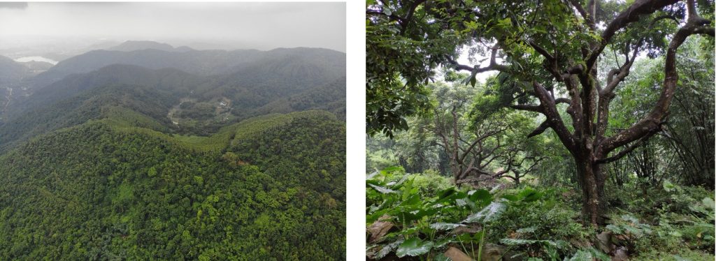
As noticed from GoogleEarth and actual site, the mission zone is located in a mountainous area with undulating topography. Yet, it has a very high vegetational cover, up to 95%. The surveyors might feel it quite difficult to move inside the mountain and staff safety is a great concern as well. Moreover, continuous GPS signal loss will be a big trouble for GNSS RTK measurements in such an environment. Insufficient fixed solutions and measured points might lead to poor accuracy control in the final mapping results.
Equipment Deployment
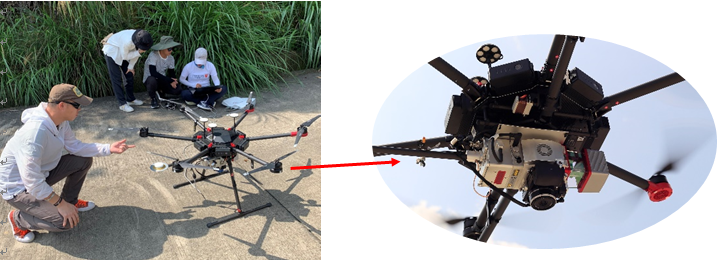
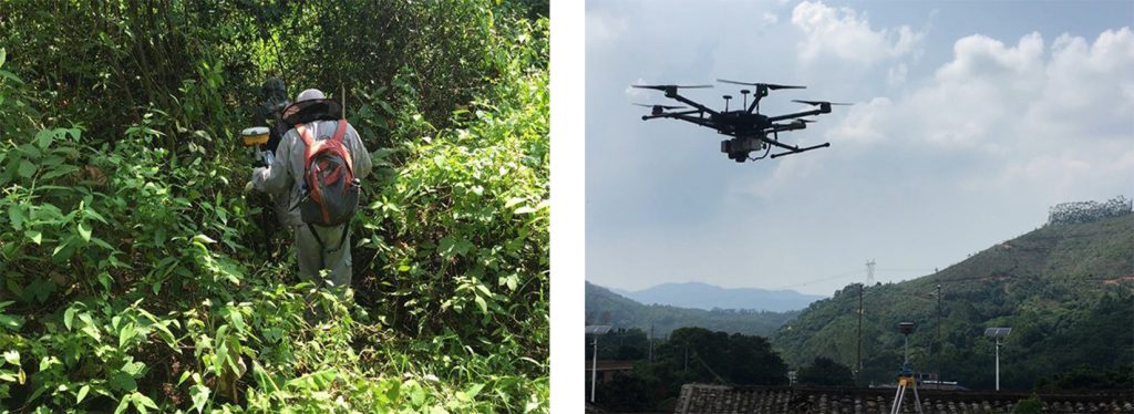
As agreed, the service provider decided to utilize UAV-based LiDAR plus DSLR camera for mobile laser scanning and aerial mapping. Only when remote sensing methodology is applied could the fieldwork data capture duration be minimized.
Site Visit and Fieldwork
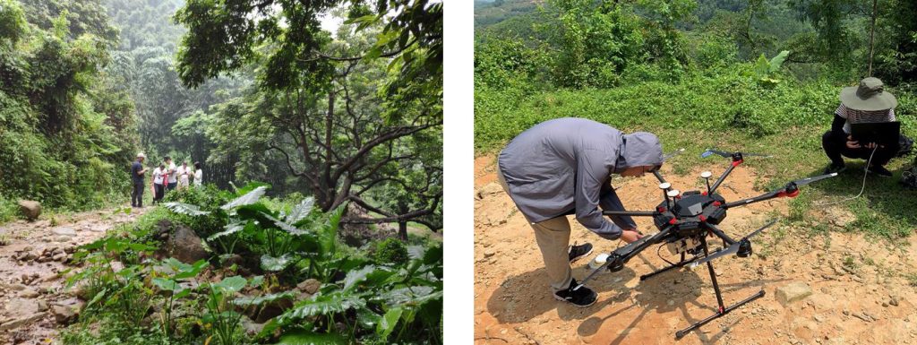
Upon arrival, the team spent half a day to visit the site and check the terrain conditions. Accordingly, they managed to fix 2 ground base points and 3 take-off spots. The data capture was completed within 5 flight missions which were actually 4 hours around. However, the traffic inside the survey zone was really a big challenge for them, so they had to hand carry all devices on foot and moved to the next take-off spots. As a result, it took them 2 days to accomplish such 5 flights for the aerial data capture
Outputs Display
Fieldwork: 2 days
Data processing: 6 days
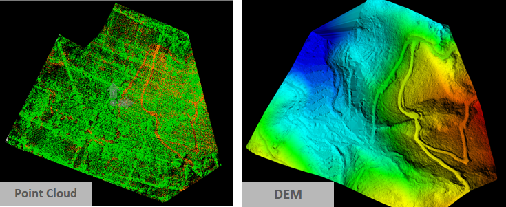
After data-processing, the point cloud density is up to 80-100 points per square meter, fully meets the mapping requirements.
The data processing and output generation were done in 6 days, so the survey team spent only one week for the job. Compared with conventional ground measurements using total station or GNSS RTK, airborne LiDAR survey enjoys an incredibly high efficiency as well as accuracy control.